System Introduction Below is information on the purpose of the drought information analysis system, the contents provided, and the system structure diagram.
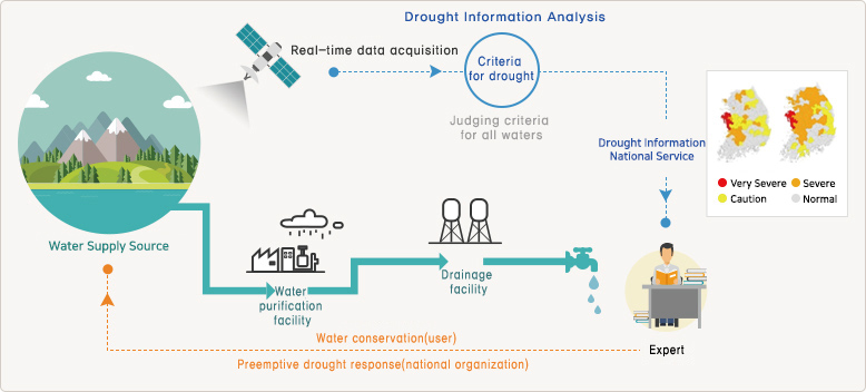
System OverviewThe National Drought Information Analysis System is a system that provides the public with relevant information on droughts. It not only recognizes droughts in advance but also acquires and shares information related to droughts with the general public, experts, governments, local governments and public institutions. Through various analysis results, we have made it possible for concerned parties to make quick and rational decisions.Even if drought occurs due to the nature of the drought, the general public cannot feel the presence of a drought. For this reason, it is necessary to improve the difficulty in dealing with the drought problems related to the drought and collect the information about water sources in real-time and reflect the system that the actual water is supplied, so that the users who use the water can directly experience the drought. Users can determine through the system whether they will experience water shortages in case of drought.In addition, the nation's leading drought experts produce and update daily information on the drought-related basic information,which is being effectively used in various fields as well as obtaining reliable information.
System ConfigurationThe system consists of 7 main menus. It is an advanced information system that can be utilized by decision makers, public officials and experts such as news and activities that enable the general public to understand drought easily and access information, drought education appropriate drought response measures, etc. Basic drought information can be easily viewed.
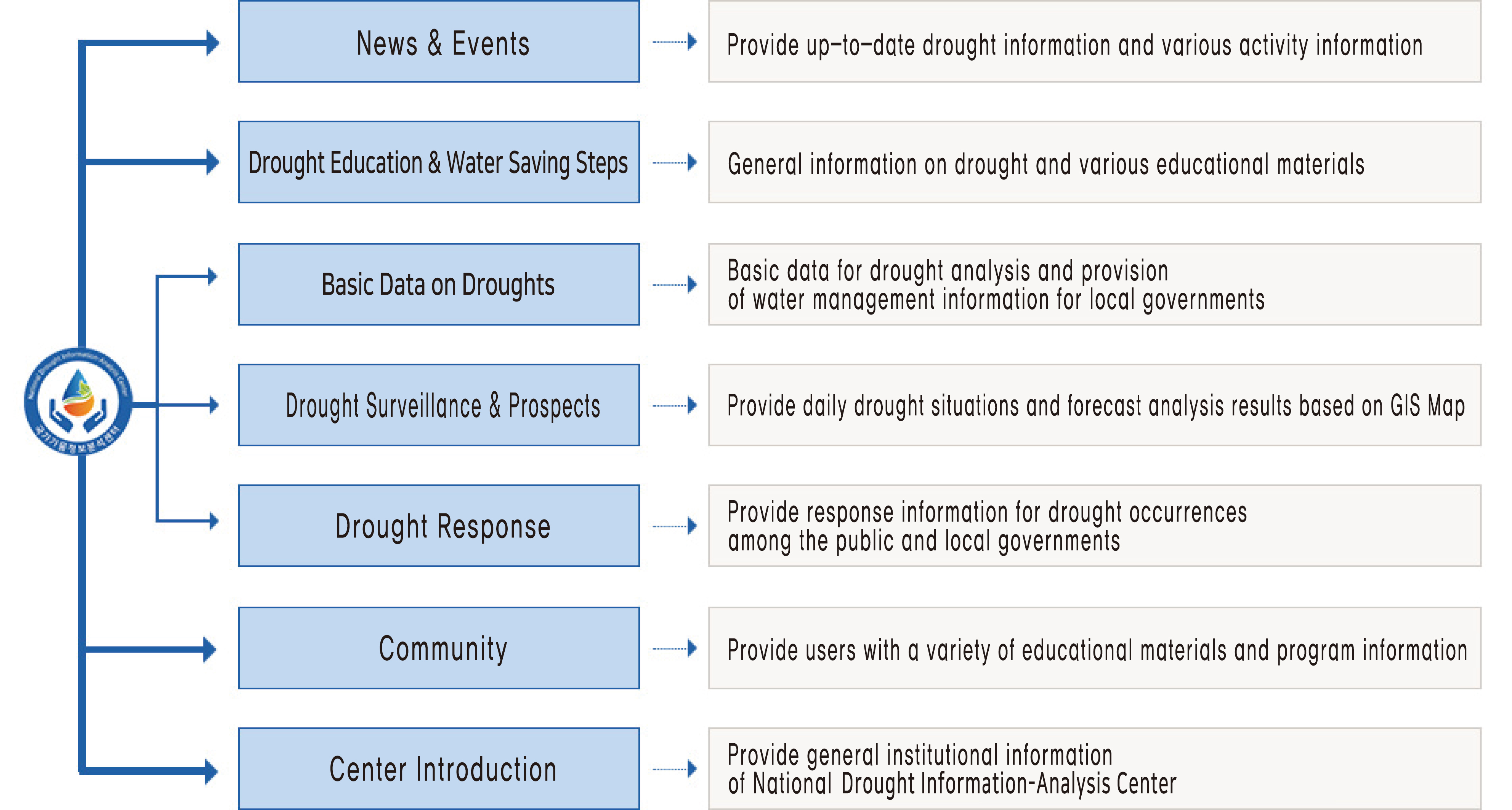
Main ContentsThe main contents are drought basic information, drought surveillance and forecasting, and on local and regional drought situations that are beneficial to non-experts.
- Local Drought Information
-
It provides contents based on GIS Map based on user location based drought information. It is designed to allow non-experts to easily check rainfall, water sources, drought status, past history, drought forecasts, and water shortage information in the area.
- Basic Information on Drought
-
It provides information based on GIS Map, which is necessary to monitor drought and analyze water shortage caused by drought. It can check information such as weather, water source, water supply system, water supply population, water quality, and satellites.
- Drought Surveillance and Prospects
-
It is structured to judge whether or not a current drought is present in a variety of ways, and to provide a forecast analysis of how the drought will progress after 1 month, 2 months and 3 months, so that 'drought measures' and 'responses' are systematically possible.
- Drought Statistics
-
We have implemented a function to analyze basic statistical information and analytical values of drought with reference to various examples and conditions.
Copyright ⓒ K-water ALL RIGHTS RESERVED.